Northeast Ohioans are fortunate to have such a vast array of parks and trails to explore! However, if you are using a stroller, wheelchair or bike, you are probably looking for easy terrain. You’re in luck because we’ve compiled a list of paved walking trails and paved bike trails to make it easy for you to get out and enjoy some fresh air and sunshine.
As usual, prior to making the trip, please use the website links and contact information provided to ensure that the trail is open. Enjoy!
Jump Directly to Specific County:
Ashtabula | Cuyahoga | Geauga | Lake | Lorain | Medina | Portage | Stark | Summit | Wayne | Paved Trails Near Me
Paved Trails in Ashtabula County
Western Reserve Greenway
44-mile paved rail trail through Ashtabula and Trumbull. 27 miles in Ashtabula County from the city of Ashtabula southward to the county line, where it continues for 17 miles into Trumbull County.
W. 52nd St. and Madison Ave. (Ashtabula) and North River Rd. (Warren)
Website
Paved Trails in Cuyahoga County
Acacia Reservation
The 1.7-mile paved loop trail is located in the Reservation
Cedar Rd., Lyndhurst, OH 44124
Website
Big Creek Reservation All Purpose Trail
8 miles of paved trail for activities, like cycling, walking, and in-line skating. Motorized vehicles are prohibited
Tiedeman Rd., Brooklyn, OH 44144
Website
Brecksville Reservation All Purpose Trail
9.3 miles of paved trail for activities, like cycling, walking, and in-line skating. Motorized vehicles are prohibited.
9000 Chippewa Creek Dr., Brecksville, OH 44141
Website
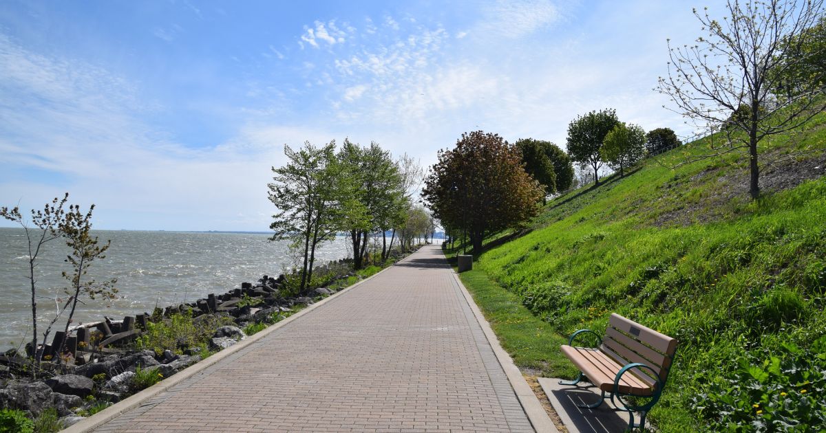
Cleveland Lakefront Bikeway
The bikeway spans the entire length of Cleveland’s 17-mile Lake Erie shoreline from the City’s eastern border with Euclid and its western border with Lakewood.
Website
Euclid Creek Reservation All Purpose Trail
2.5 miles of paved trail for activities, like cycling, walking, and in-line skating. Motorized vehicles are prohibited.
Euclid, OH 44143
Website
Garfield Park Reservation All Purpose Trail
3.9 miles of paved trails for activities such as cycling, walking, and in-line skating. Motorized vehicles are prohibited.
11350 Broadway Ave., Garfield Heights, OH 44125
Website
Harrison-Dillard Bikeway
The bikeway runs parallel to MLK Drive for 3.74 miles through Cleveland’s Cultural Gardens in Rockefeller Park.
Website
Hinckley Reservation All Purpose Trail
3.3 miles of paved trails for activities such as cycling, walking, and inline skating. Motorized vehicles are prohibited.
Hinckley, OH 44233
Website
Lake to Lake Trail
The Lake to Lakes Trail connects Lake Erie to the Shaker Lakes through Rockefeller Park and University Circle.
Mill Stream Run Reservation All Purpose Trail
8.9 miles of paved trails for activities such as cycling, walking, and inline skating. Motorized vehicles are prohibited
9485 Eastland Rd., Strongsville, OH 44149
Website
Morgana Run Trail
The paved trail runs along an old rail corridor through the Slavic Village Neighborhood. The trail begins on E. 49th Street just north of Fleet Ave and terminates near the Garfield MetroParks Reservation. The trail ends on the south at the tallest waterfall in Cuyahoga County, at Mill Creek, where it meets the trail to Garfield Reservation.
Website
North Chagrin Reservation All Purpose Trail
4.2 miles of paved trails for activities such as cycling, walking, and in-line skating. Motorized vehicles are prohibited.
3037 Som Center Rd., Willoughby Hills, OH 44094
Website
Ohio & Erie Canal Reservation All Purpose Trail
7.2 miles of paved trails for activities such as cycling, walking, and in-line skating. Motorized vehicles are prohibited.
4524 E. 49th St., Cleveland, OH 44125
Website
Rocky River Reservation All Purpose Trail
13.6 miles of paved trails for activities such as cycling, walking, and in-line skating. Motorized vehicles are prohibited.
24000 Valley Pkwy., North Olmsted, OH 44070
Website
South Chagrin Reservation All Purpose Trail
A paved trail for activities like cycling, walking, and in-line skating. Motorized vehicles are prohibited.
37374 Miles Rd., Bentleyville, OH 44022
Website
Paved Trails in Geauga County
Beartown Lakes Reservation – Lake Trail
.7-mile paved all-purpose Lake Trail around Lower Bear Lake
18870 Quinn Rd., Chagrin Falls, OH 44023 (Auburn & Bainbridge Townships)
Website
Bessie Benner Metzenbaum Park – Evergreen Trail & Griswold Creek Trail
The .3 mile paved Evergreen Trail loops through the beech woods and conifer plantation, and the .2 mile Griswold Creek Trail takes visitors across the stream and through the wetlands.
7940 Cedar Rd., Chesterland, OH 44026
Website
Big Creek Park – Cascade Trail & Ruth Kennan Trail
.1 mile Cascade trail and .2 mile Ruth Kennan trail
9160 Robinson Rd., Chardon, OH 44024
Website
Burton Wetlands Nature Preserve – Glacier Trail
.22-mile Glacier Trail leads from the parking lot to the boardwalk and observation deck overlooking Lake Kelso.
15681 Old Rider Rd., Burton, OH 44021
Website
Chickagami Park – Overlook Trail
.12-mile trail around Overlook Shelter
17957 Tavern Rd. (Route 168), Parkman, OH 44021
Website
Frohring Meadows – Dragonfly Trail
7-mile fully accessible paved walkway.
16780 Savage Rd., Chagrin Falls, OH 44023
Website
Maple Highlands Trail
A 20.3-mile-long linear park that utilizes sections of the abandoned Baltimore & Ohio (B&O) Railroad corridor. The trail currently extends from Colburn Road on the Lake County line southeast to Swine Creek Reservation in Middlefield, with a brief break in the City of Chardon, currently in the process of creating its connector trail
9280 Ravenna Rd., Chardon, OH 44024
Website
Observatory Park – All four trails
1-mile Planetary Trail with interactive pods representing each planet, a .25-mile Weather Trail with interactive stations representing ways to study weather, life-sized cornerstones of the Great Pyramid of Giza, earthen mounds, henge stones, an entrance drive and parking lot, and a 1.85-mile Woodland Trail.
10610 Clay St., Montville, OH 44064
Website
Orchard Hills Park – Sledge, Cricket & Harvest Trails
Formerly operated as Orchard Hills Golf Course, the .15-mile Sedge, .6-mile Cricket, and .75-mile Harvest trails are paved and utilize portions of former cart paths.
11340 Caves Rd., Chesterland, OH 44026
Website
Sunnybrook Preserve – Pine Ridge Trail
The .37 mile Pine Ridge Trail, located just off the parking and shelter area, provides a fully accessible route through the forest and alongside nearby wetlands.
12474 Heath Rd., Chesterland, OH 44026
Website
Swine Creek Reservation – Killdeer & Sugarbush Trail
16004 Hayes Rd., Middlefield, OH 44062
Website
The Rookery – Woodcock Trail
.4-mile Woodcock Trail, a short loop trail, has a deck overlooking an abandoned oxbow of the Chagrin River.
10110 Cedar Rd., Munson, OH 44026
Website
The West Woods – Discovery & Neighbors Way Trails
The .3 mile Discovery Trail leads visitors past vernal pools, or the .1 mile Neighbors Way from the nature center to the picnic shelters
9465 Kinsman Rd., Russell, OH 44072
Website
Walter C. Best Wildlife Preserve – All 3 trails
Paved .5-mile Goldenrod and the 1-mile Cattail Trails provide for a scenic walk or jog around the lake and fishing platforms. .1 mile Waterfowl Walkway takes visitors to the Wildlife Observation Blind to enjoy waterfowl activity
11620 Ravenna Rd., Munson, OH 44024
Website
Paved Trails in Lake County
Chagrin River Park
Two paved trails, Brambleside Loop Trail (.9 miles) and Reeves Trail (.3 miles).
East Entrance, 3100 Reeves Rd., Kirtland, OH 44094
Website
Edward R. Walsh Park
A picnic pavilion, new playground, baseball/softball field, restrooms, soccer, fishing pond with barrier-free dock, five tennis courts, two basketball courts, water spray park, and a 1-1/2 mile paved walkway.
7221 Bellflower Rd., Mentor, OH 44060
Website
Greenway Corridor
The 5.1-mile paved trail is for visitors to exercise in the beauty of nature. The southern end of the trail connects the Greenway Corridor with the Maple Highlands Trail to Chardon.
Trailheads:
– Rt. 84 & Liberty St., Painesville, OH 44077
– Old Stone School, 7125 Ravenna Rd., Concord Twp., OH 44077
– 7371 Ravenna Rd., Concord Twp., OH 44077
– 10850 Girdled Rd., Concord Twp., OH 44077
– Jordon Creek Park, 7250 Alexander Rd., Concord Twp., OH 44077
Website
Lakeshore Reservation
Four paved trails: All People’s Loop (.62 miles), Ramble Lane Trail (.28 miles), Warbler Way (.30 miles), and Meadow Edge Loop Trail (.33 miles)
4799 Lockwood Rd., North Perry Village, OH 44081
Website
Civic Center Park
Civic Center Park, adjacent to the Mentor Municipal Center and the Mentor High School campus, is one of Mentor’s largest parks. It contains the Civic Center Waterpark, Civic Arena, Skatepark, and a paved bike path.
8600 Munson Rd., Mentor, OH 44060
Website
Veterans Park
The park offers a 1.78-mile loop trail through native wetlands with 830 feet of boardwalk and a wetland/wildlife viewing area.
5730 Hopkins Rd., Mentor, OH 44060
Website
Paved Trails in Lorain County
Amherst Beaver Creek Reservation – Beaver Creek Trail
A 1.5-mile asphalt trail loops past a small cattail marsh, into the Beaver Creek Valley, and through a pine forest. The trail can be accessed from the main parking lot or from the neighborhood trailhead on North Main Street.
913 N. Lake St., Amherst, OH 44001
Website
Black River Reservation – Bridgeway Trail & Steel Mill Trail
Black River Reservation features 6.5 miles of paved all-purpose trail, which follows the Black River through its meanderings, and connects High Meadows on Ford Road in Elyria to Route 611. The Bridgeway Trail is highlighted by a 1,000-foot bridge that crosses the Black River twice. The Steel Mill Trail is connected to the Bridgeway Trail and is highlighted by slag fields from the Steel Mill surrounding it.
– High Meadows: 1750 Ford Rd., Elyria, OH 44035
– Bur Oak: 6150 Ford Rd., Elyria, OH 44035
– Day’s Dam: 2720 E. 31st St., Lorain, OH 44055
Website
Columbia Reservation – Heron Trail
1 mile of paved trail.
25145 Royalton Rd., Columbia Station, OH 44028
Website
Kopf Family Reservation
The over 3-mile asphalt trail winds through the forest, allowing visitors to explore the flora and fauna. The trail travels from the Avon Lake Public Library to Belle Road Park and has a southern loop that comes back to Belle Road Park. Visitors can also access the trail just east of the Avon Lake Public Library on Electric Boulevard, and on side roads including Woodstock St, Armour St., and Hunter St. at Belle Road Park.
32649 Electric Blvd., Avon Lake, OH 44012
Website
North Coast Inland Trail – Lorain County
The all-purpose trail is open to non-motorized traffic of all kinds (except skateboards), including walkers, runners, bicyclists, in-line skaters, and cross-country skiers. The trail’s long 13 miles of straight-aways pass through a variety of countryside, including farms, fields, and forest, and numerous intersections serve as convenient places to jump on or off the trail.
Downtown Kipton to Downtown Elyria – Multiple bike trail access points
Website
Wellington Reservation – Loop Trails
More than 4 miles of paved and crushed stone trails meander through the Wellington Reservation’s grassland fields and wetland habitats. Each loop highlights a different section of the park, providing visitors with a variety of vistas across the lake, from atop an elevated observation mound, and throughout the intermittent wetlands in the grassland prairies.
535 Jones Rd., Wellington, OH 44090
Website
Paved Trails in Mahoning County
Boardman Park
Four paved trails, including North Trail (0.45 Miles), Maag Walk (0.07 Miles), Eisenhower Trail (0.30 Miles), and the Hike and Bike Trail (0.54 Miles)
375 Boardman-Poland Rd., Boardman, OH 44512
Website
Trails at Mill Creek Metroparks – Website
- Albert E. Davies Wetland Trail – This barrier-free, 1/4-mile boardwalk leads visitors through the Newport Wetlands to an observation deck overlooking several deep water pools.
- East Cohasset Hike & Bike Trail – This 1.5-mile asphalt surface drive is closed to motorized traffic and provides joggers, walkers, and bikers a scenic route above Lake Cohasset.
- East Newport Hike & Bike Trail – This one-way road is open to motorized traffic and has a 1.75-mile designated hike/bike lane. Views of Lake Newport, Newport Wetlands, and Daffodil Meadow will be enjoyed along this trail.
- East Golf Hike & Bike Trail – The 1.5-mile East Golf Hike & Bike Trail runs from Route 224 to Shields Rd. and provides an asphalt surface for joggers, walkers, bikers, skaters, and, in the snowy season, cross-country skiers. Parking lots are located at each end of the trail, and a pedestrian bridge across Mill Creek connects the trail with Golf Course amenities and additional parking. Restrooms, a drinking fountain, and an information kiosk are located on the trail.
- Virginia J. Axtmann Nature Trail for all People – .1 mile paved trail with nature signage
MetroParks Bikeway
An 11-mile paved trail offers a variety of scenery for hikers, skaters, and bicyclists. The MetroParks Bikeway runs from Western Reserve Road in Canfield Township to the Mahoning County/Trumbull County Line in Austintown Township.
– Kirk Road Trailhead – 6685 Kirk Rd., Canfield, OH 44406 (GPS: 41.068974, -80.788235)
– Mahoning Ave. Trailhead – 16 Harold St., Youngstown, OH 44515 (GPS: 41.099635, -80.790376)
– MetroParks Farm Trailhead – 7574 Columbiana-Canfield Rd, Canfield, OH 44406
Website
Paved Trails in Medina County
Allardale – Inner Loop Trail
Half-mile paved trail.
401 Remsen Rd., Medina, OH 44256
Website
Buckeye Woods Park – Large Lake Loop
Half-mile paved trail.
6335 Wedgewood Rd., Medina, OH 44256
Website
Carolyn Ludwig Mugrage Park – Storywalk Trail
Inclusive playground, a dog park, and a fun 1-mile paved story walk trail.
4985 Windfall Rd., Medina, OH 44256
Website
Chippewa Rail Trail
2.75 miles paved. There is a parking lot located on the south side of Chippewa Rd., approximately a quarter-mile east of Lake Rd., that provides access to the rail trail.
5700 Chippewa Rd., Medina, OH 44256
Website
Hubbard Valley Park – All Persons Trail
A .5-mile paved all-purpose trail leads to a picnic shelter, around the back of the sledding hill, to the restrooms, to the bridge that leads to the hiking trail, and to the fishing area.
8600 Hubbard Valley Rd., Seville, OH 44273
Website
Lake Medina – Lower Trail
The 1.63-mile Lake Medina Trail is an asphalt path that follows the willows and sycamores along the West Branch of the Rocky River and connects to the city of Medina’s paved trail along Reagan Parkway.
Website
Plum Creek Park – All Persons Trail
Half-mile paved trail.
Website
River Styx Park – All Persons Trail
A .5-mile paved loop trail circles the three-acre pond found at this site and passes through a wooded area
8200 River Styx Rd., Wadsworth, OH 44281
Website
Susan Hambley Nature Center – Paved Bike Trail
Half-mile paved trail.
1473 Parschen Blvd., Brunswick, OH 44212
Website
Fred Greenwood Park & Splash Pad
Covering 38 acres of land across from A.I. Root Middle School. Short 1/8 mile paved walking trail, playground, and splash pad.
333 W. Sturbridge Dr., Medina, OH 44256
Website
Paved Trails in Portage County
Berlin Lake Trail
2.2-mile limestone-paved trail.
– 232 Kirkbride Rd., North Benton, OH 44449
– 10228 US 224, Deerfield, OH 44411
Website
Headwaters Trail
8-mile limestone-paved trail.
– 4633 Mill St., Mantua, OH 44255
– 10602 Vaughn Rd., Mantua, OH 44255
– 10446 Asbury Rd., Hiram Twp.
– 10480 State Route 700, Garrettsville, OH 44231
– 10647 Freedom St., Garrettsville, OH 44231
– 10482 South St., Garrettsville, OH 44321 (Garrettsville Village Park)
Website
Portage Hike & Bike Trail – Franklin Connector
A 7.07-mile multipurpose trail from Ravenna to Kent and beyond.
Parking for Park District-managed sections is available at:
– 535 Cleveland Rd., Ravenna, OH 44266
– 1557 Lake Rockwell Rd., Kent, OH 44240
– 2264 Ravenna Rd., Kent, OH 44240
– 7173 Hudson Rd. and 784 Judson Rd., Kent, OH 44240 (Franklin Connector)
Website
Paved Trails in Stark County
Fairhope Nature Preserve
There are seven nature trails at the preserve; most are under a half mile each.
4242 30th St. NE, Canton, OH 44705
Hartville Memorial Park
Enjoy the .7-mile paved walking trail throughout the park.
335 Park Ln. Dr. SW, Hartville, OH 44632
Huston-Brumbaugh Nature Center – All Persons Trail
Enjoy a .5-mile boardwalk through the woods. Highlights along this trail are the pond observation deck, barn with farm animals to pet, and a view of the herb garden.
16146 Daniel St. NE, Minerva, OH 44657
Website
Iron Horse Trail
The 4.58-mile limestone surface trail begins at the First Christian Church (FCC) and continues south to Canfield Street.
First Christian Church, 1141 W. Beech St., Alliance, OH 44601
Website
Jackson Township North Park Walking Path
Enjoy the 1.1-mile paved walking track around the park, playground, lake, and ball fields.
7660 Fulton Rd. NW, Massillon, OH 44646
Website
Minerva Connector Trail
A .45-mile trail following Sandy Creek from E. Lincoln Way to Stadium Street. The trail takes you to the shelters, playground equipment, and tennis courts in Municipal Park and to Minerva High School.
501 Almeda Ave., Minerva, OH 44657 (next to Minerva High School)
Website
Olde Muskingum Trail
A 5.74-mile limestone surface trail. This scenic route follows along the western edge of the Tuscarawas River near the Ohio & Erie Canal and parallels an active railroad from Canal Fulton to Jackson Township.
Parking at 220 Cherry St. W, Canal Fulton, OH 44614
Website
Petros Lake Park – Loop Trail
A limestone trail that loops around the 13-acre Petros Lake.
3519 Perry Dr. SW, Canton, OH 44706
Website
Price Park
Large pond with tons of ducks, a large playground with a lot of shade, and a 1-mile paved walking trail.
1000 W. Maple St., North Canton, OH 44720
Website
Quail Hollow Park – Nature for All Trail
The park features more than 700 acres of rolling meadows, marshes, pine, and deciduous woods surrounding a 40-room house. This paved trail is .35 miles.
13480 Congress Lake Ave., Hartville, OH 44632
Website
Sippo Valley Trail
Explore 8 miles between Bottoms Park in Massillon and Dalton in Wayne County, ending just north of Rt. 30. The Sippo Valley Trail also connects to the Towpath Trail at the west side of Tremont Ave. in Massillon. An asphalt trail surface transitions to limestone between Skyland Ave. and Deerfield Ave. The flat, gentle grades parallel Sippo Creek for much of the route.
2069 Skyland Ave. NW, Massillon, OH 44647
Website
Stadium Park – Herbert L. Fisher Walking Track
A rubberized, 1.5-mile lit path.
Stadium Park Dr. NW, Canton, OH 44718
Website
Veterans Community Park Walking Path – Middle Branch Trail
A 1.5-mile paved trail throughout the park, a playground, and a dog park
1714 Schneider St. NE, Canton, OH 44721
Website
West Branch Trail
Pass several of Canton’s biggest tourist attractions as you walk or bike along this limestone trail connecting West Park, the former Mother Goose Land, Waterworks Park, Monument Park, Stadium Park, Ink Park, and Covered Bridge Park. The trail follows the West Branch of the Nimishillen Creek.
1305 Stadium Park Dr. NW, Canton, OH 44708
Website
Westbrook Veterans Memorial Park
.29-mile track around the pond, where people can also fish. Home to the Stark County Veterans’ Memorial. The memorial is open every day from dawn to dusk, and it is free to enter.
1235 Harrison Ave. NW, Canton, OH 44708
Website
Paved Trails in Summit County
Bike & Hike Trail – Barlow Road Trailhead
The trail surface is asphalt, and the grade is flat. There is a slight grade after 1/4 mile, where participants have to cross a very quiet residential street to continue on the trail.
Barlow Lot, 331 Barlow Rd., Hudson, OH 44236
Website
Boettler Park
A 1.2-mile asphalt walking trail.
5300 Massillon Rd., North Canton, OH 44720
Website
Central Park in Green
A 1-mile asphalt walking trail.
1795 Steese Rd., Uniontown, OH 44685
Website
Croghan Park
A .36-mile paved walking path, playground, and sports fields.
Intersection of North Miller Rd. and Sand Run Pkwy., Fairlawn, OH
Website
Fort Island / Griffiths Park
This 60-acre park contains a large playground, a nature center, a paved walking trail, and more.
413 Trunko Rd., Fairlawn, OH 44333
Website
Freedom Trail – Middlebury Trailhead
The surface of the 6.2-mile Freedom Trail is asphalt, and the grade is flat.
Middlebury Trailhead, 1324 Middlebury Rd., Kent, OH 44240
Website
John Torok Community & Senior Center
A .5-mile walking asphalt paved path.
4224 Massillon Rd., North Canton, OH 44720
Website
Liberty Park – Maple Loop Trail
The flat, easy, and paved Maple Loop Trail begins near the parking lot and travels through the beech-maple woods.
Twinsburg Ledges Area & Nature Center, 9999 Liberty Rd., Twinsburg, OH 44087
Website
Munroe Falls Metro Park – Meadow Loop Trail
A paved .35-mile trail that loops near the parking lot.
Tallmadge Meadows Area, 1088 North Ave., Tallmadge, OH 44278
Website
Towpath Trail – Clinton Trailhead
The trail surface is mostly asphalt, and the grade is flat.
Clinton Trailhead, 2749 North St., Clinton, OH 44216
Website
(Towpath Trail includes 11 other trailheads in Akron, Barberton, and New Franklin; find them all here.)
Wingfoot Lake State Park
A paved walking trail over covered bridges, past boat docks, picnic shelters, and throughout the entire park.
993 Goodyear Park Blvd., Mogadore, OH 44260
Website
Paved Trails in Wayne County
Barnes Preserve
Nearly a mile of ADA asphalted trails, woods hiking, wildlife and bird watching, and observing aquatic life at the wetland pond.
3396 Sylvan Rd., Wooster, OH 44691
Website
County Line Trail
Creston to Rittman (6.8 miles)
Website
Heartland Trail
Orrville and Clinton
Website
Johnson Woods State National Preserve
13240 Fox Lake Rd., Marshallville, OH 44645
Website
Secrest Arboretum
2122 Williams Rd., Wooster, OH 44691
Website
Sippo Valley Trail
Dalton to Massillon (10.5 miles)
Website
Map of Local Paved Trail Locations
Find a Paved Trail Near Me
Don’t forget Sunny Lake Park in Aurora! Portage county.
Thank you for this nice list of paved paths. My wife and I recently bought electric scooters. We’re 50+ so we’re not zooming along, just looking for places to go for a nice relaxing ride. I appreciate the list and the inclusion of motorized prohibits where known.